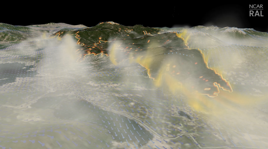
Improving Wildfire Prediction with Cutting Edge Satellite Imagery and Artificial Intelligence (AI)
“One of our main challenges in wildfire modeling has been to get accurate input, including fuel data. In this study, we show that the combined use of machine learning and satellite imagery provides a viable solution.” Amy DeCastro, NCAR | RAL Project Scientist
")