To Flee or not to Flee?
A Category 2 hurricane has been forecast to hit the area in the next five days. Do you board up the house and evacuate? Or stay, ride it out and hope it isn’t a direct hit?
More and more people are moving to coastal areas on the East Coast and Gulf of Mexico, which means potential for greater numbers of fatalities, injuries and damage to infrastructure. According to the National Climatic Center, over the last 10 years, the United States has been battered by some very expensive hurricanes in history with a total price tag of more than $347 billion (2013 Consumer Price Index cost adjusted value).
A coordinated research effort is underway that aims to significantly improve hurricane track, intensity and storm surge forecasts. Scientists at NCAR are providing invaluable support to NOAA’s Hurricane Forecast Improvement Program (HFIP), the goals of which are to improve the accuracy and reliability of hurricane forecasts; to extend lead time for hurricane forecasts with increased certainty; and to increase confidence in hurricane forecasts. Meteorologists in the trenches at the National Hurricane Center, whose job is to make the forecasts that the public and emergency managers rely on, are counting on improved forecasts of track and intensity seven days out.
A good forecast depends on a reliable, accurate computer model. “Numerical model” is the term the experts use, which involves complex mathematical equations. While algorithms may not be sexy to many, they play an essential role in building a model that could be the difference between life and death. There are numerous experimental tropical cyclone models that have been developed by researchers in labs, universities and agencies. Some are more accurate, more useful than others. NCAR’s Tropical Cyclone Modeling Team (TCMT) has the very difficult job of objectively evaluating these experimental models.
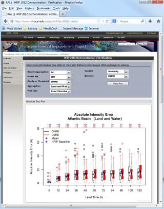
NOAA’s operational forecasting group at the National Hurricane Center depends on the NCAR team to perform independent, pre-season testing and evaluation of models based on specific criteria provided by the operations side. NCAR’s Tropical Cyclone Modeling Team acts as an “honest broker,” systematically evaluating models used the summer prior to the hurricane season, and deciding if the selected models performed as well as expected during a real trial during the hurricane season (Aug-Oct). They scrutinize the latest innovations and improvements (if any) on previous years’ (past three years) storms, and determine if the models’ performance meets the NHC’s criteria for selection for the coming hurricane season. If any models satisfy the stringent testing and evaluation, they could eventually be used for operational purposes.
“HFIP’s goal is to improve the quality of the models used by NHC, and NCAR’s evaluations have been an absolutely critical part of that process. Our forecasters already have an overwhelming amount of data to sift through in order to prepare our forecasts and warnings, and each year HFIP offers us 5-10 new or improved models for potential use. So we need to know which of these new models are going to really contribute to better forecasts and which might just waste our time, and we just wouldn’t have been able to make intelligent decisions about which is which without their evaluations. It’s been a great experience working with the TCMT team to come up with new and clever ways to do these tests and present the results, and I’d love to take some of the verification techniques they’ve developed and adopt them here.”
James Franklin
Branch Chief, Hurricane Specialist Unit
National Hurricane Center
