Better forecasts through GPS
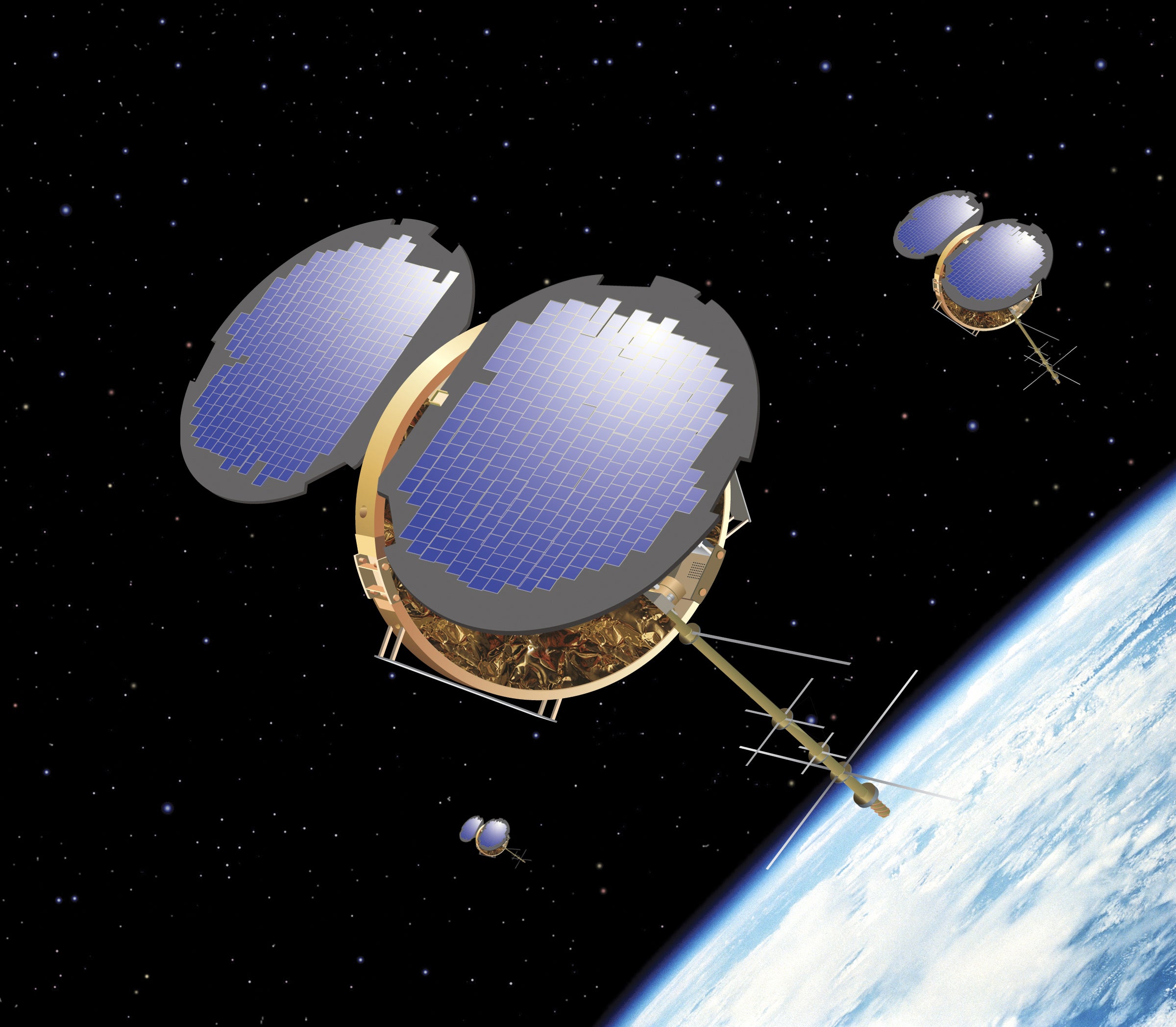
June 1, 2012 • An observing system that was only a gleam in researchers’ eyes in the 1990s is now a key tool for monitoring Earth’s atmosphere. COSMIC (Constellation Observing System for Meteorology, Ionosphere, and Climate) is a set of six small satellites, launched in 2006, that track GPS signals and use them to infer temperature, moisture, and other atmospheric qualities around the globe.
COSMIC’s benefits are many and varied:
- The system, funded by the U.S. and Taiwan governments, has been shown to help with one of the toughest, most important forecast challenges on Earth: predicting hurricane track and intensity.
- Because COSMIC covers the globe in three dimensions, and its data are unusually stable, the system also serves as a useful global thermometer for monitoring climate change.
- Model-based weather forecasts in the United States and other countries are measurably better thanks to COSMIC.
- The system even captures the structure of phenomena in the ionosphere, hundreds of miles above ground, that other systems can’t fully profile.
An ambitious follow-up project was given the green light in February 2012. With initial support from Taiwan and the U.S. Air Force, COSMIC-2 is slated to send a half-dozen next-generation satellites into orbit in 2016 and another six in 2018. COSMIC-2 will track signals from other navigation systems in addition to GPS, including Russia’s GLONASS (Global Navigation Satellite System) and Europe’s Galileo.
The larger number of satellites in COSMIC-2, together with technological advances and strategic positioning, could yield up to ten times the data gathered by the current satellites.
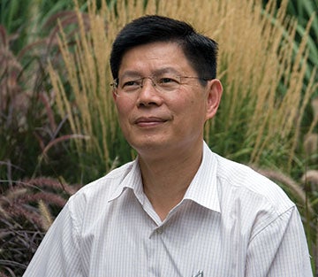
“The COSMIC-2 mission will provide a revolutionary increase in the number of atmospheric and ionospheric observations that will greatly benefit research and forecasting,” says Ying-Hwa “Bill” Kuo, who manages the COSMIC Project Office at UCAR.
How it works
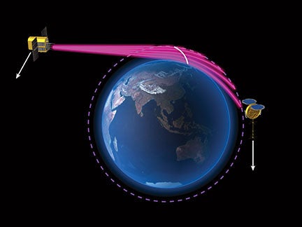
COSMIC is a collaboration between science agencies in the United States and Taiwan, where the project is known as FORMOSAT-3. Its roots lie in an NSF-funded experimental satellite mission called GPS-MET, led by UCAR, that employed a technique called radio occultation (RO). In the 1960s, scientists at the Jet Propulsion Laboratory and Stanford University had figured out how to use the distortion of radio waves to measure other planets’ atmospheres.
The technique wasn’t applied to Earth’s own atmosphere until the advent of GPS, whose worldwide reach made it an ideal, if accidental, weather sensor. As the atmosphere becomes more dense or more moist, GPS signals are slowed and bent slightly. By intercepting a signal and analyzing how it’s been changed by the air, scientists can infer atmospheric density and, in turn, temperature and moisture. The technique also gauges the density of electrons in the upper atmosphere, which helps illuminate the impacts of solar magnetism.
Many scientists doubted that the GPS-MET test would yield fruit. But the 1995 launch—which involved a shoebox-sized GPS sensor aboard a microsatellite not much larger than a suitcase—proved them wrong. Not long afterward, a supertyphoon that ravaged Taiwan inspired that nation’s scientific leaders to seek ways to improve weather prediction.
Taiwan ended up providing 80% of the $100 million cost of COSMIC, with the rest coming from U.S. sponsors that included NSF, NOAA, NASA, and the U.S. Department of Defense. Several other systems using radio occultation have emerged around the world in the last few years, including efforts led by Argentina, Germany, Italy, and the European Space Agency (see sidebar below).
UCAR serves as a data processing base for COSMIC as well as a scientific hub. The program sponsors meetings that draw researchers from around the world to discuss progress in weather forecasting and climate monitoring made possible by the system’s data. And a student program has introduced the many benefits of radio occultation to future forecasters and researchers in Taiwan and the United States.
At NOAA’s National Centers for Environmental Prediction, which runs computer models used across the country for daily weather forecasts, COSMIC data have improved temperature forecasts and advanced the prediction skill of four-day model forecasts by an additional eight hours. At the European Center for Medium-Range Weather Forecasts (ECMWF), a study that evaluated the usefulness of various data types on reducing forecast error put COSMIC and a similar European system in 5th place out of 24 systems, despite the relatively small number of measurements from GPS radio occultation compared with other satellite systems.
“COSMIC measurements have had a significant impact on weather forecasting,” says the ECMWF’s Sean Healy. “They are clearly an important part of the global observing system.”
Cost-effective and highly accurate
Radio occultation systems are also economical. The compact satellites are launched into orbit at fairly low altitudes—only about 500 miles (800 kilometers) high, compared to the 22,000-mile height of geostationary weather satellites that sit above a fixed point on Earth. The smaller size, lighter weight, and lower orbit require less manufacturing expense and rocket power, which translates into lower cost.
Because the GPS signals are so stable, the atmospheric measurements derived from them are extremely accurate. The average error in equivalent temperature (an index that removes the effects of moisture) is roughly plus or minus 0.05°C (0.03°F) In contrast, the average measurement bias of a balloon-borne thermometer is plus or minus 0.2°C in the troposphere (the atmosphere’s lowest layer), increasing to 0.5° in the stratosphere. Global temperature estimates from COSMIC are especially useful from the stratosphere upward, where few other techniques are available. Due to their high accuracy and stability, GPS radio occultation measurements are considered the most reliable global tool for measuring global temperature change over time.
“I’ve talked with many of the inventors and developers of the GPS system, and none of them anticipated that it could be used with such high accuracy,” says GPS-MET principal investigator Randolph “Stick” Ware, now with the firm Radiometrics.
Like all satellites, the COSMIC fleet has a limited lifespan. Designed to last about five years, it is now more than six years old. Several of its six satellites are partially or completely disabled, mainly due to failing batteries. Still, COSMIC produces around 1,000 atmospheric profiles each day, which continue to boost the quality of U.S. weather forecasts from NOAA. This spring the agency will begin incorporating the bending angles of the radio occultation signals, which will allow models to accept data from as high as 50 km (31 mi) compared to the former upper limit of 30 km (19 mi). This should help improve the model’s depiction of the lower stratosphere, where the seeds of major winter storms and other high-impact weather are sometimes planted weeks in advance.
As the first COSMIC mission nears the end of its life, other systems around the world will help fill in the gaps until COSMIC-2 arrives. The first six of the COSMIC-2 satellites will be positioned at lower latitudes than the original constellation in order to glean more data on the tropical atmosphere, where vast stretches of ocean are still poorly sampled.
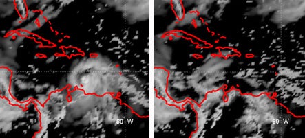
At the University of California, Davis, graduate student Xue Meng Chen calls the COSMIC observations “a valuable dataset.” She found that they improved the model-based prediction of intensity for 2006’s Hurricane Helene, the strongest Atlantic storm of that year. NCAR’s Hui Liu carried out a similar study for another 2006 storm, Hurricane Ernesto. He found that COSMIC data led to a better description of rich moisture surrounding and nourishing the storm. Without the COSMIC data, one forecast model used in the study predicted only scattered showers rather than a developing hurricane.
“Hurricanes and other tropical weather features can still be very challenging to forecast,” says Kuo. “COSMIC-2 should help lead to major improvements in tropical prediction.”